DGPS Level Survey for a 30+ KM Canal Network in Gujarat: What the Field Actually Looked Like
When Gujarat's Irrigation Department needed a precise level survey of an existing and proposed DGPS canal network spanning over 30 kilometres, the challenge was not just the distance. It was the terrain. Dense scrub, unmarked water bodies, active streams cutting across the route, and a catchment area that simply had no footpath. Every survey point had to be reached on foot, physically, by a person with an instrument. This is the field report from that project.
The Project Brief: Canal Planning Needs Ground Truth
The Gujarat state Irrigation Department commissioned this survey for a proposed canal that would draw water from an existing source and distribute it through a network serving agricultural land across the region. Before any design or construction begins, the department needed three things: an accurate level profile of the proposed 30+ km canal route, capture of the full catchment area feeding the water source, and documentation of existing canal alignments for comparison with the proposed route.
This is standard pre-design survey work, but the deliverables demand centimetre-level vertical accuracy. Canal design is unforgiving. A 10 cm error in cross-sectional level data can throw off gradient calculations for hundreds of metres downstream. The contractor cannot afford approximate data, and the department cannot approve a design built on it.
The Terrain: Why This Survey Required Physical Presence
The route passed through Gujarat's interior, and the catchment zone was largely uncultivated land. What that means on the ground: thick thorn scrub, uneven rocky outcrops, seasonal water bodies that had no marked boundaries, and agricultural field edges that crossed the alignment at odd angles.
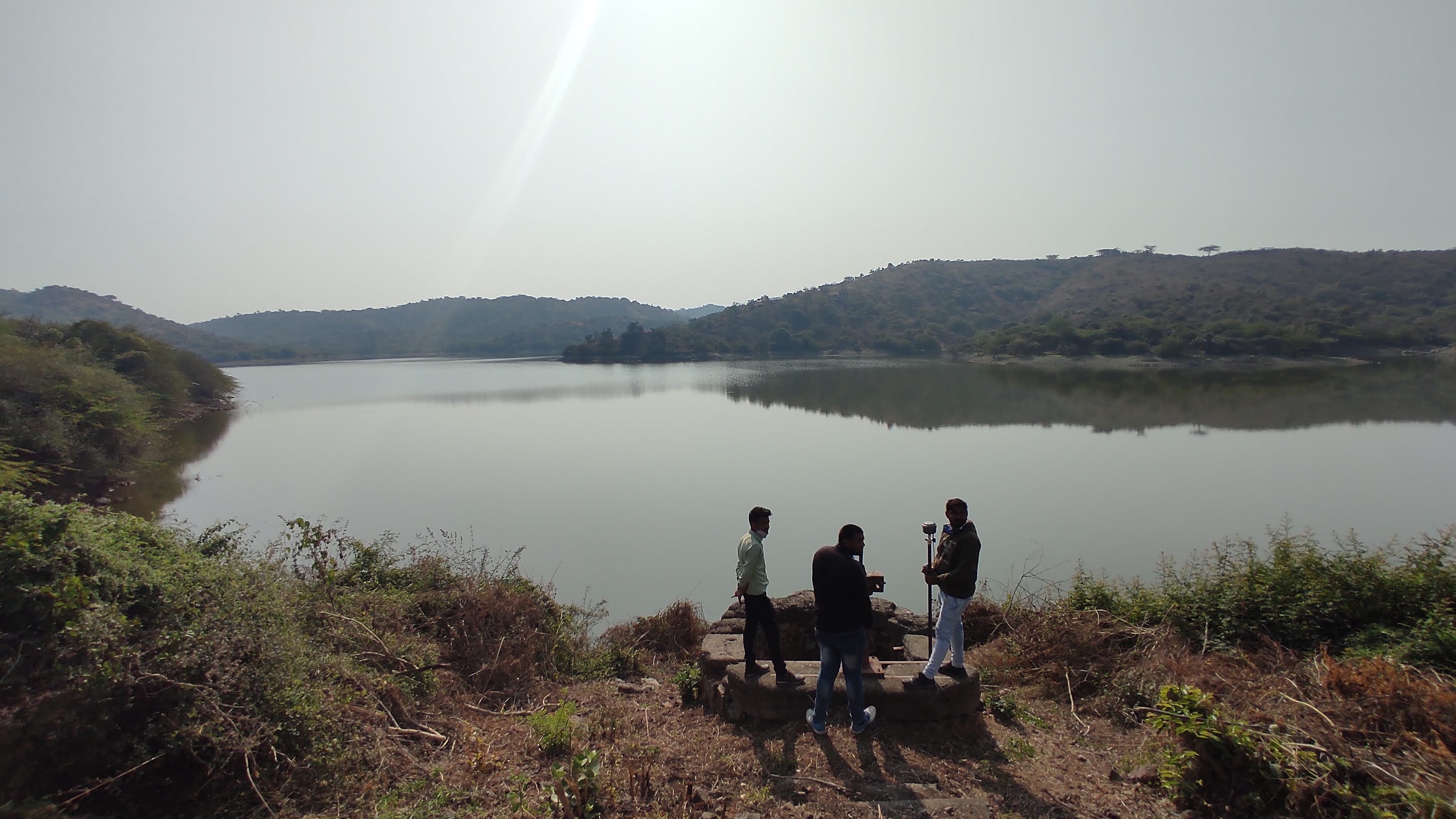
Survey point near the lake where the water intake well is located. Establishing this point accurately sets the datum for the entire downstream level network.
There is no drone shortcut for this type of work. LiDAR and photogrammetry are powerful tools for area capture, but a level survey for canal design needs cross-sections and longitudinal profiles at defined chainages along the alignment, with points placed exactly where the engineer specifies. That means a surveyor, a rod man, and an instrument physically at each point. On terrain like this, that is slow, deliberate work.
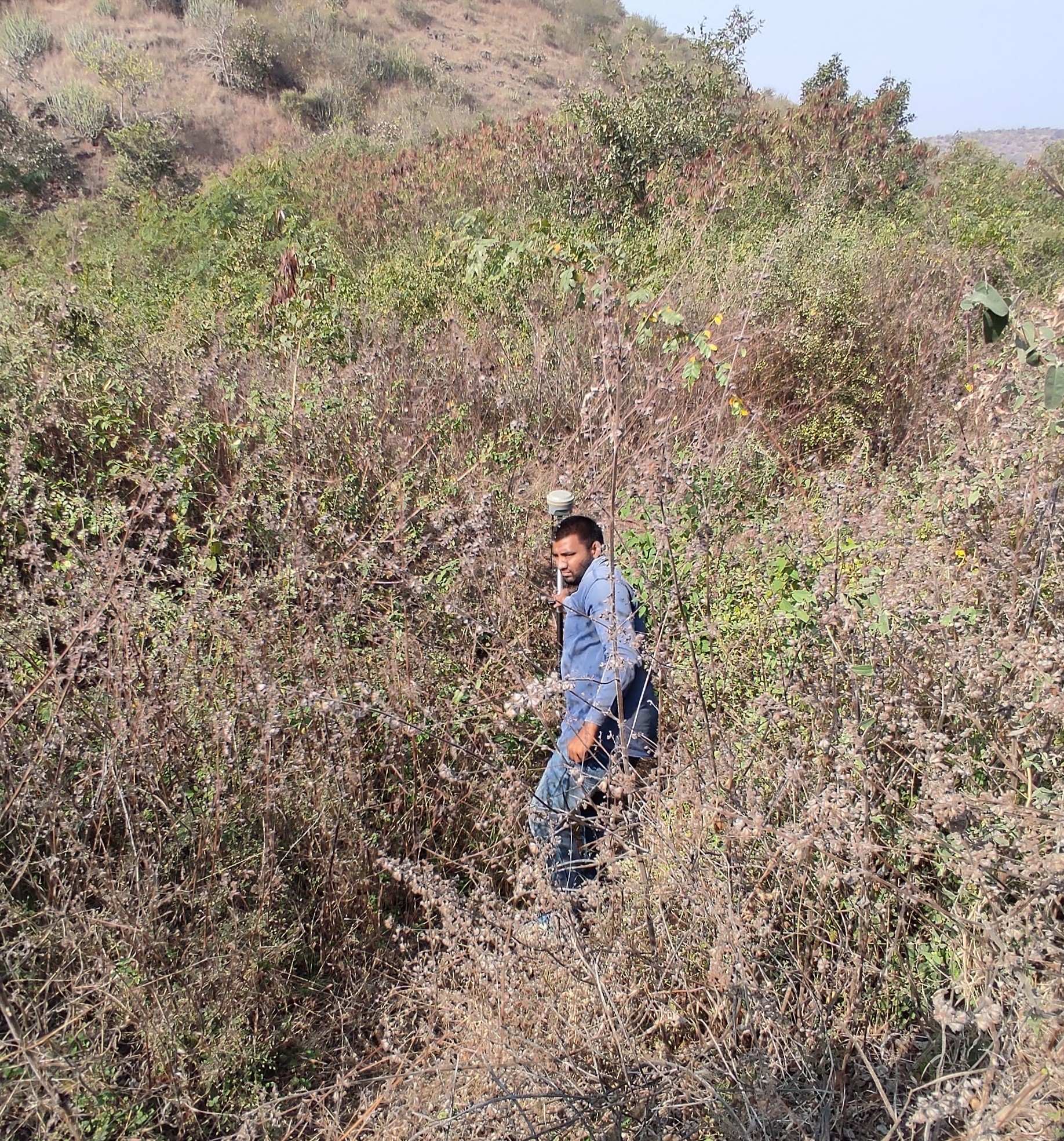
Representative terrain along the proposed canal corridor. Movement through this required clearing a path before instrument setup.
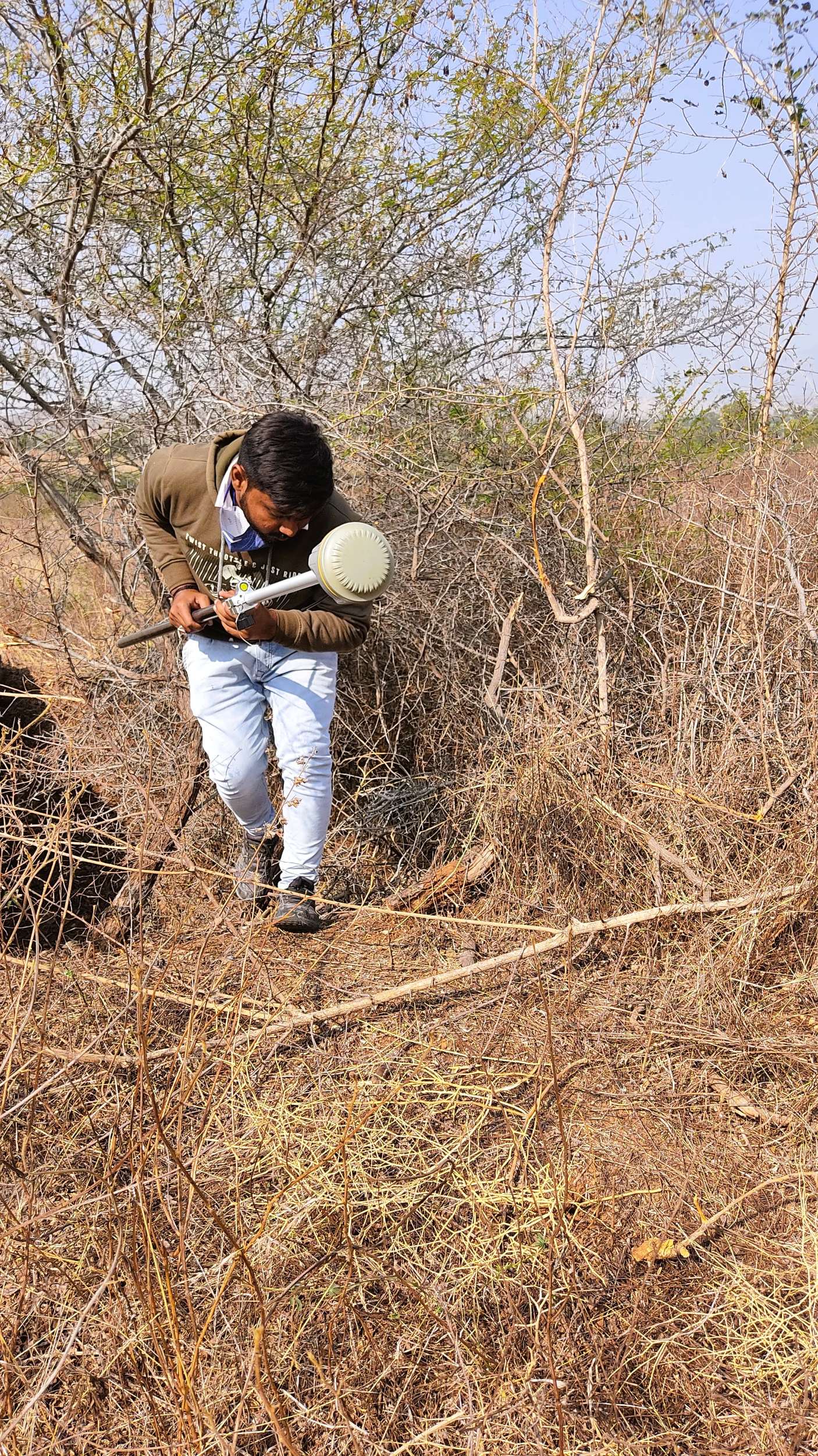
Another section of the alignment. In areas this dense, progress was measured in hundreds of metres per day, not kilometres.
Field Operations: How the 15 Days Were Structured
A team of 10+ field personnel was deployed, split across roles: DGPS operators, rod men, local guides, and data logging support. The work proceeded in overlapping phases rather than strictly sequential ones, which allowed parallel capture of the catchment area while the alignment team moved along the canal route.
The first task was establishing a reliable control network. DGPS base stations were set up at stable, intervisible points, and a series of GCPs (Ground Control Points) were occupied across the project area to define a consistent datum. All subsequent readings were tied back to this network. This step cannot be rushed: a poorly established control network produces errors that compound across the entire 30 km route.
Water Bodies: Multiple Features, Each Requiring Its Own Method
The project area contained several small natural water bodies, active seasonal streams, and a functioning canal. Each presented a different capture challenge.
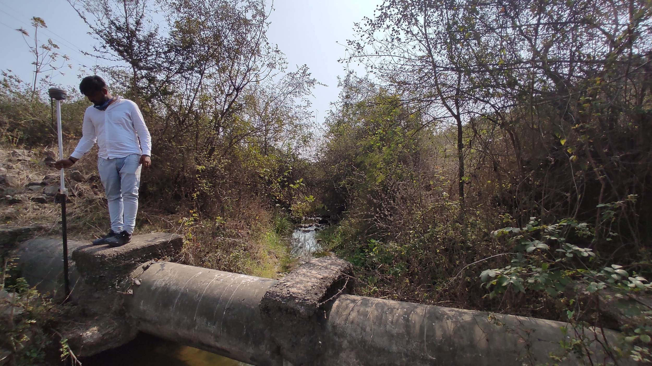
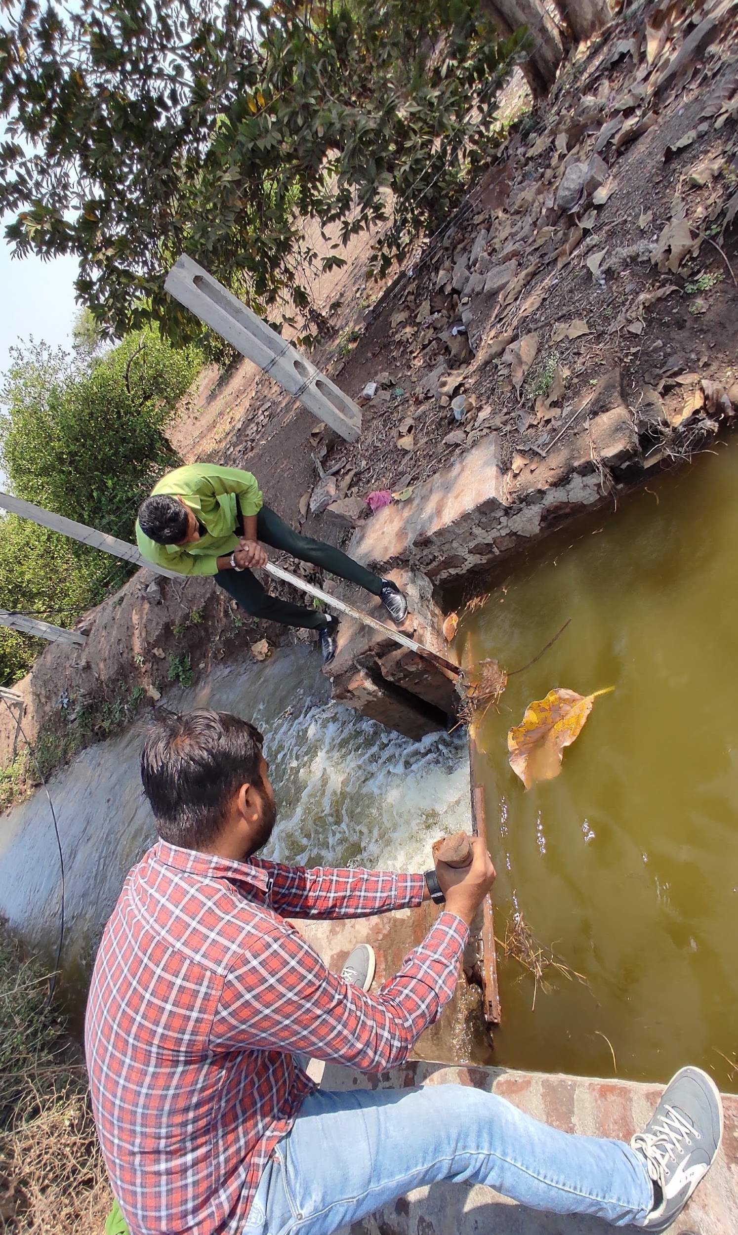
Taking readings at an active natural stream crossing the proposed alignment. Stream bed levels and bank elevations are critical inputs for drainage structure design.
For natural streams, the team captured bank-full levels, bed elevation at the crossing point, and the immediate upstream and downstream profiles. These readings feed directly into the hydraulic design of cross-drainage structures: culverts, aqueducts, or syphons depending on the relative levels of the canal and the stream.
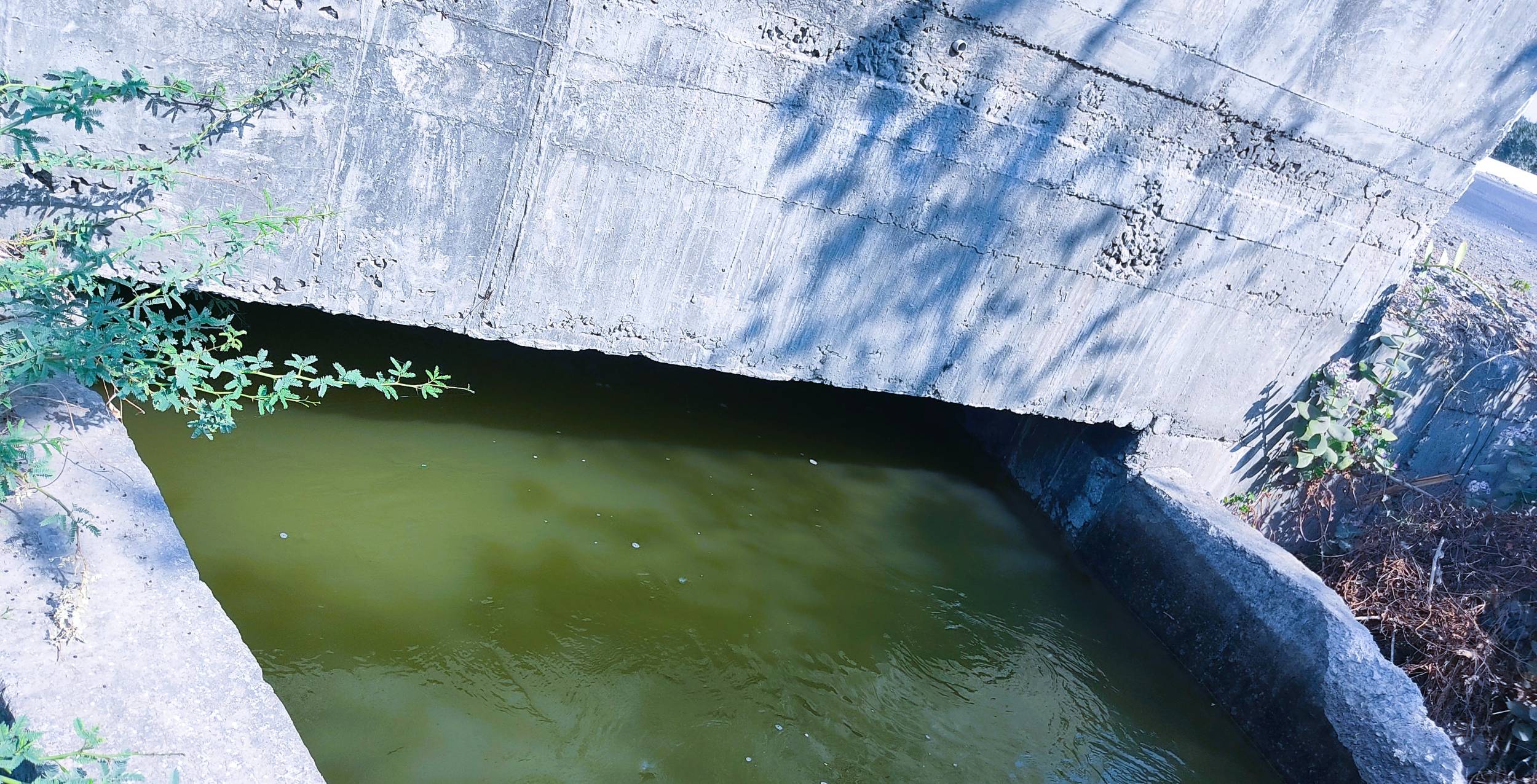
Depth reading on an active existing canal section. Full supply level, bed level, and bank levels were captured at regular intervals.
The existing canal was surveyed for its current full supply level, bed level, side slope dimensions, and bank elevations at cross-sections spaced to capture any significant change in geometry. This data allows the department to compare the existing system's actual performance against design intent, and to plan how the proposed canal will connect into or diverge from the existing network.
Survey at a canal road crossing. These points are critical: road surface levels, canal invert, and headroom clearances all need to be captured and verified against design drawings.
Road crossings required particular attention. Where the proposed canal alignment crosses an existing road, the survey captured road surface levels, sub-base levels where accessible, and the proposed canal invert at the crossing. This data is used directly by the design team to size bridges or culverts and confirm adequate headroom under existing structures.
What the Data Delivers: Survey Output for Canal Design
| Deliverable | Format | Used For |
|---|---|---|
| Longitudinal Level Profile | AutoCAD DWG / PDF | Canal gradient design, fall structure placement |
| Cross-Sections at Chainages | AutoCAD DWG / Excel | Earthwork quantity calculation, side slope design |
| Catchment Area Map | GIS Shapefile / PDF | Hydrology study, water availability estimation |
| Existing Canal Inventory | GIS Layer / DWG | Integration with proposed network design |
| Water Body Survey Points | CSV / GIS | Cross-drainage structure design |
| Road Crossing Details | DWG Detail Sheets | Bridge and culvert sizing |
| Control Point Register | PDF / Excel | Future extension surveys, design verification |
The Human Side: Local Support Made a Difference
A detail worth recording: the local farming community in the villages along the route was consistently helpful. Farmers gave the team access across their fields, pointed out informal paths through dense scrub, and in some cases helped clear vegetation around instrument positions. This kind of local cooperation is not guaranteed and should not be taken for granted. It shortened transit times between survey points in several areas and kept the 15-day schedule achievable despite the terrain.
Where Things Go Wrong in Canal Survey Projects
- Skipping cross-sections between marked chainages to save time
- Not surveying stream crossings during or after rainfall, missing actual flood levels
- Using only a single base station for a 30 km route without intermediate checks
- Ignoring road crossing sub-base levels, leaving bridge designers without critical data
- Delivering raw CSV point clouds without processed profiles and sections
- Cross-sections captured at every design chainage plus at all visible ground breaks
- Stream readings taken at multiple stages including during active flow
- Multiple base station setups with loop closures verified across the full route
- Road crossings surveyed with full pavement and sub-grade detail where accessible
- Fully processed longitudinal profiles and cross-section drawings in DWG and PDF
See the Survey in Action
This short clip shows the team and terrain from the Gujarat canal survey project, giving a realistic sense of field conditions.
Why DGPS Level Survey Still Requires Experienced Field Teams
There is a tendency to assume that because DGPS instruments are highly automated, the skill requirement has dropped. It has not. The instrument handles positioning. The surveyor handles everything else: recognising where a ground break requires an additional reading, understanding which stream bank elevation will actually matter for drainage design, spotting when a benchmark has shifted and flagging it before it contaminates the dataset, knowing how to place the base station to maintain satellite geometry across a 30 km route.
On this Gujarat project, the 15 days were not slow. Given the terrain, the number of water body crossings, and the catchment area extent, 15 days with a 10+ person team represents efficient, well-organised field operations. The alternative is a faster survey with gaps, assumptions, and data that the design engineer cannot use with confidence.
Get a Quote for Your Canal or Irrigation Survey Project
If you are working on a canal alignment, irrigation network, or catchment area survey for a government department or private client, contact Trishunya directly. We work across India, and Gujarat is a state where we have active project experience. Tell us your route length, deliverable format, and timeline, and we will give you a specific scope and cost on the same day.
Get a Same-Day Quote on WhatsAppLet's have a quick chat about your project. 💬 Quick WhatsApp Chat
Call Trishunya for your next project.