Power Transmission Line Survey
We facilitate optimal routing and execution of transmission line projects through high-precision corridor mapping, ROW estimation, tower spotting, and tree enumeration.
We facilitate optimal routing and execution of transmission line projects through high-precision corridor mapping, ROW estimation, tower spotting, and tree enumeration.
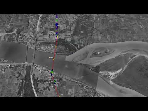
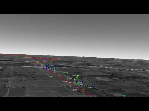
Rapid corridor mapping over difficult terrain.
Proven experience with industry leaders.
Comprehensive ROW documentation for faster clearances.
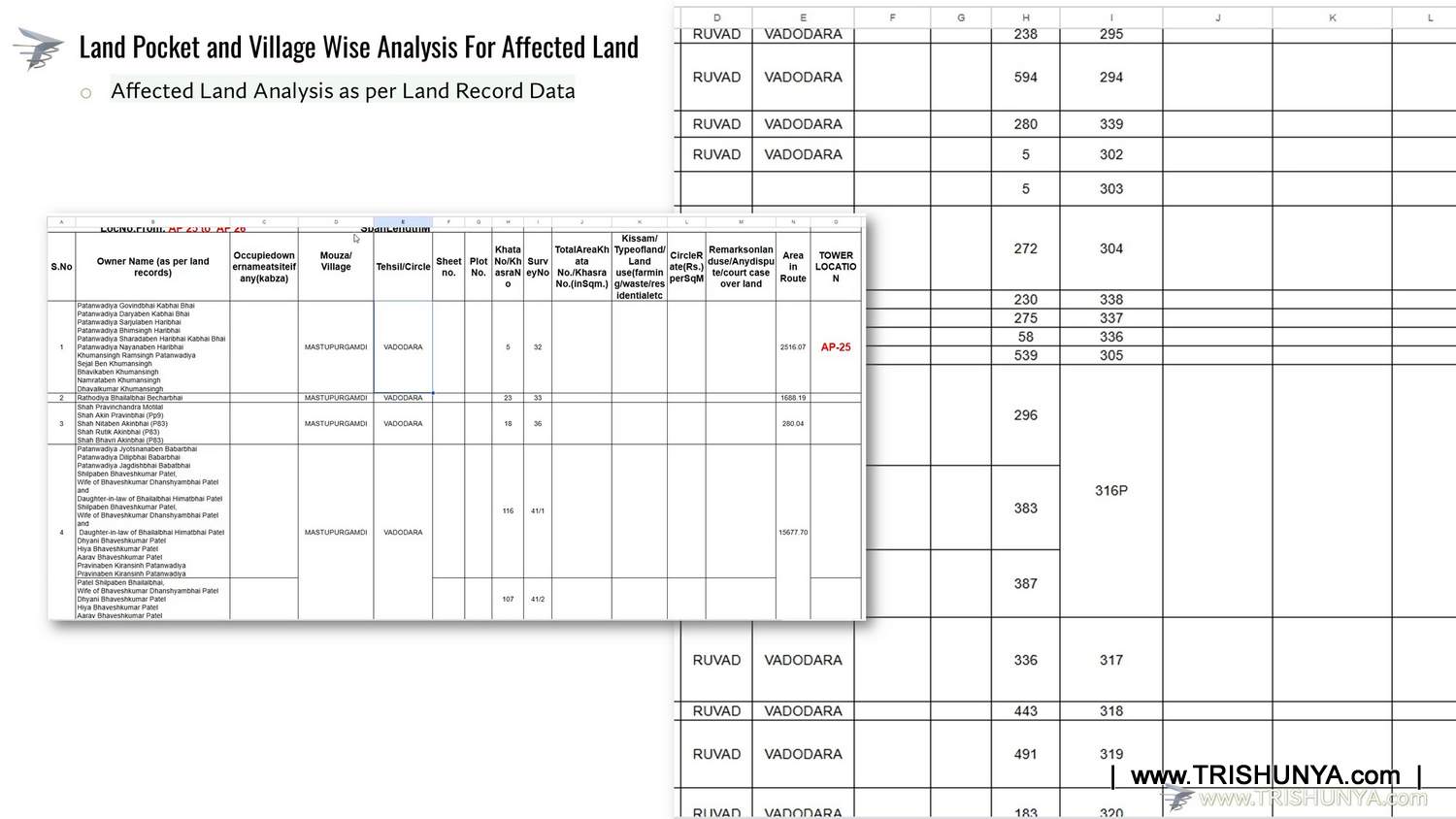
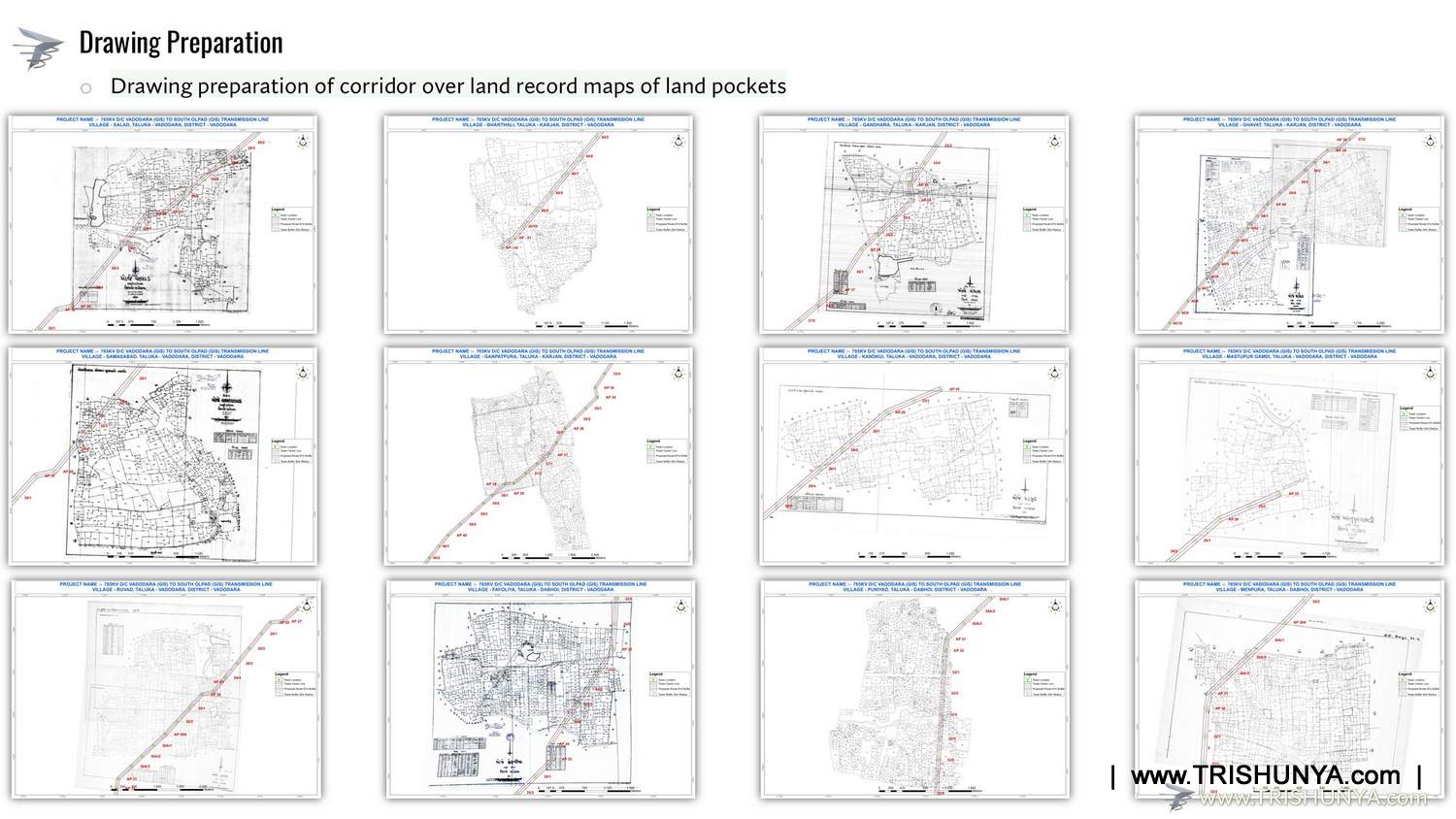
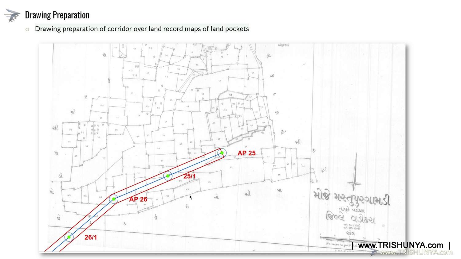
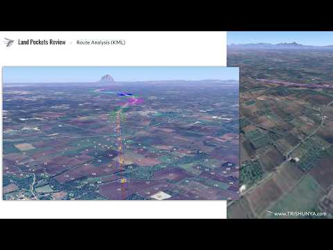
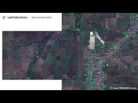
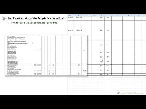
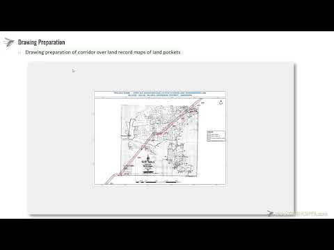
Village map and land cutting documentation for land acquisition.
| Work Type | Description | Equipment Used | Deliverable |
|---|---|---|---|
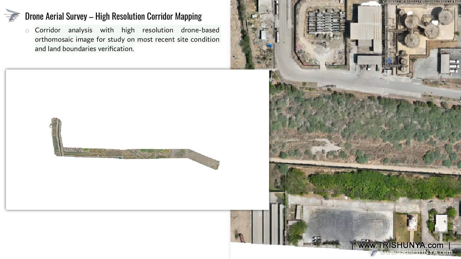
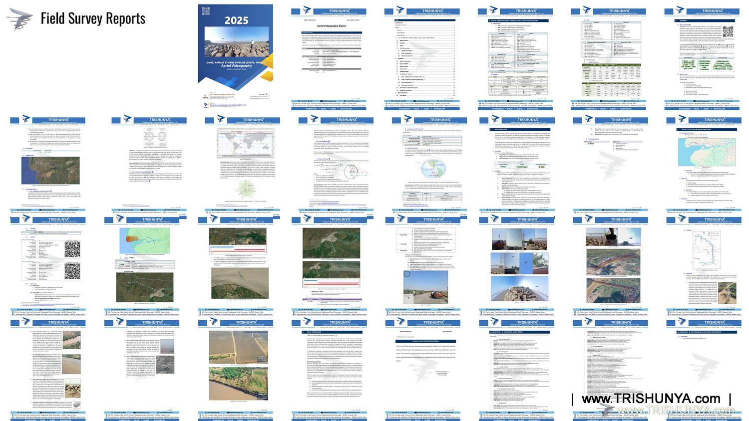
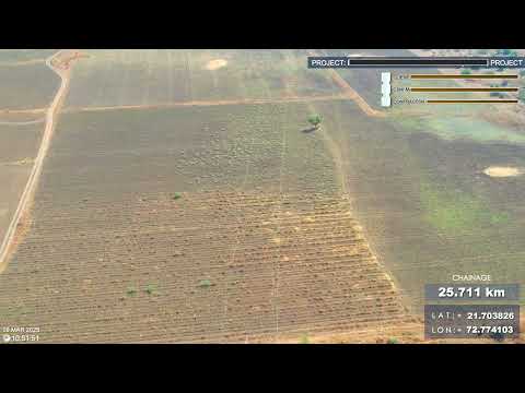
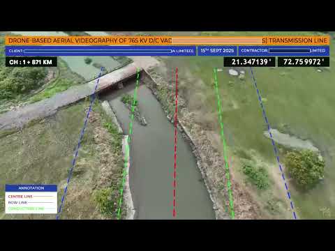
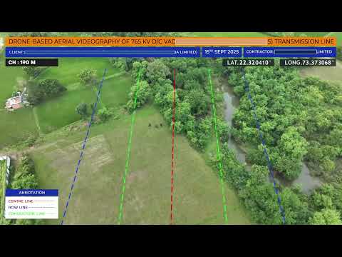
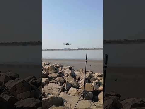
| Telemetry Video | High-definition aerial and ground video for corridor reconnaissance. | Drone 360° Cam | Video with Chainage, GPS, Markups |
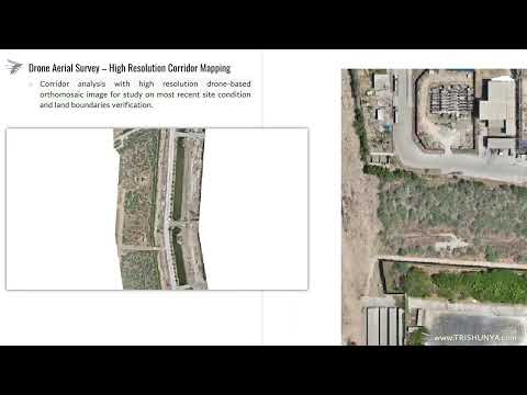
| DEM, DTM & ORTHO | Digital Elevation/Terrain Models and Orthomosaic for terrain analysis. | Drone | GeoTiff — DEM / DTM / Orthomosaic |
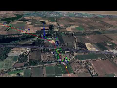
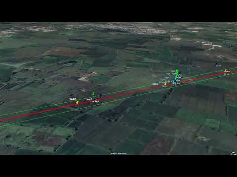
| Topography | Detailed mapping of natural and man-made features along the corridor. | Drone DGPS | Topography Drawing |
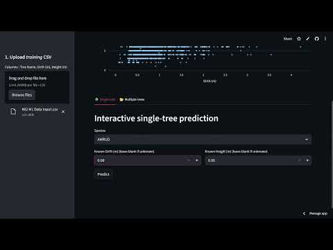
| Tree Enumeration | Accurate counting and classification of vegetation within the ROW. | GPS | Geotagged tree data-sheet |
| Stakeout | Physical marking of tower foundation points with millimeter-level accuracy. | DGPS Total Station | Field Work — Marking |
| Land Acquisition | Detailed land parcel maps and documentation for legal acquisition process. | Analysis Documentation | Village map based acquisition drawing |
| Feature Geo Tagging | Digital tagging of critical assets and obstacles with precise coordinates. | Drone DGPS | Geotagged Drawing or Feature File |
.jpg)
2.jpg)
.jpg)
.jpg)
.jpg)
.jpg)
.jpg)
1.jpg)
.jpg)
.jpg)
.jpg)
.jpg)
.jpg)
.jpg)
.jpg)
.jpg)
.jpg)
.jpg)
.jpg)
.jpg)
.jpg)
.jpg)
.jpg)
.jpg)
.jpg)
.jpg)
.jpg)
.jpg)


Get a same-day quote for Power Transmission Line Survey anywhere in India.
Send WhatsApp Enquiry